

Esri Ireland Partners With Causeway Coast and Glens Borough Council to Boost Local Tourism
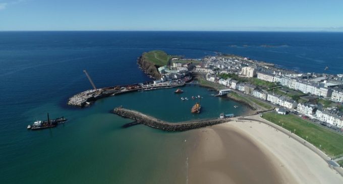
Esri Ireland, the market leader in geographic information services, has announced that Causeway Coast and Glens Borough Council has used its digital mapping software to boost local tourism through a series of interactive online maps. The Council has seen significant tourism growth in the Causeway Coast and Glens region, with 1.1 million overnight visitors adding £194 million to the local economy in the last year.
Causeway Coast and Glens Borough Council is a local authority covering 140,000 people across Ballymoney, Coleraine, Limavady and Moyle regions. With over 800 staff, the Council is responsible for overseeing planning, economic development and recreational activities in the area.
Using Esri‘s digital mapping software, Causeway Coast and Glens Borough Council has curated a number of interactive story maps to engage those visiting the area and promote local tourism. One popular online map developed by the Council displays Game of Thrones filming locations across the Causeway Coast and Glens and has been viewed over 11,000 times to date.
The Council has also developed several interactive guides for local events such as the North West 200 and the Armoy Road Races Tour, as well as a guide for the upcoming 148th Open Golf Championship at Royal Portrush. The prestigious competition is set to significantly boost the local economy, with the economic benefit expected to be in the region of £80 million.
The guide will provide the 190,000 attendees with comprehensive event information including competition details, drone footage of the course, and nearby facilities, attractions and accommodation. The map will also be used by emergency response teams, with evacuation routes and first aid provisions plotted out.
Coleraine Borough Council initially engaged with Esri Ireland in 2008 – which then amalgamated with three other Councils into Causeway Coast and Glens Borough Council in 2015 – to move data collection and storage away from outdated paper-based and manual processes to an innovative, real-time digital platform. Esri Ireland’s mapping platform has digitally transformed the Council’s operations, leading to reduced query response time and greatly enhancing in-house productivity and task efficiency.
Employees now utilise Esri’s data collection app, Survey 123, to input real-time information from any location to easily create visually appealing and data rich maps which provide management with readily available and actionable information. The platform is being utilised by the Council across its entire range of services, including local planning, risk assessments, water hygiene and quality assessments, and for many more applications.
Nial McSorley, Digital Service Manager, Causeway Coast and Glen Borough Council, said: “Esri’s mapping platform has had a huge impact on how we operate as a Council. It has enabled our teams to easily collect, store, analyse and share data for the entire range of services we offer residents and visitors in the area.
“The technology and how we’ve applied it has also enabled us to develop truly engaging and innovate story maps that allow visitors to get the most from their trip to the Causeway Coast and Glens. Attracting visitors to our area is extremely important for our local economy, with 12% of local employment directly related to tourism. Leveraging Esri’s software, has enabled us to highlight the fantastic amenities and events in our area, serving as a really useful resource for visitors and communicating to others why Causeway Coast and Glens is such a great destination to visit.”
Philip McLaughlin, Client Manager, Esri Ireland, said: “Causeway Coast and Glens Borough Council have been exemplary in terms of how a local Council can leverage software to greatly enhance its operations and promote tourism in their area. We’re delighted that the Council has realised the adaptability of Esri’s software and been so proactive in engaging with the technology to attract more visitors to an area full of rich history, culture and enjoyment.”


